Long and narrow, Anguilla got its name from eels.
Because of its shape, Anguilla got its name from the scientific name for eels. The local Arawak tribes called the island Malliouhana.
Below (on the left), is a simple map of Anguilla from Google Maps (you can click on the image to view it directly in Google Maps.).
Skyviews has a much more detailed, very high quality map of Anguilla. You can see it below on the right and can also click on it. Be warned: it takes a long time to load, requires Flash and as such should be viewed on a PC. Note: This is the same high quality paper map you can usually find all over the island (we highly recommend it).
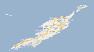
Anguilla map (click on image to view it in Google Maps)
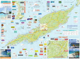
Skyviews map (click on image to view it at Skyviews)
Anguilla relative to Puerto Rico
Anguilla is about 140 miles east of Puerto Rico (the large island under the Puerto Rican flag in the image below).

Other Maps of the Caribbean
The World Atlas web site has a nice map of the Caribbean.